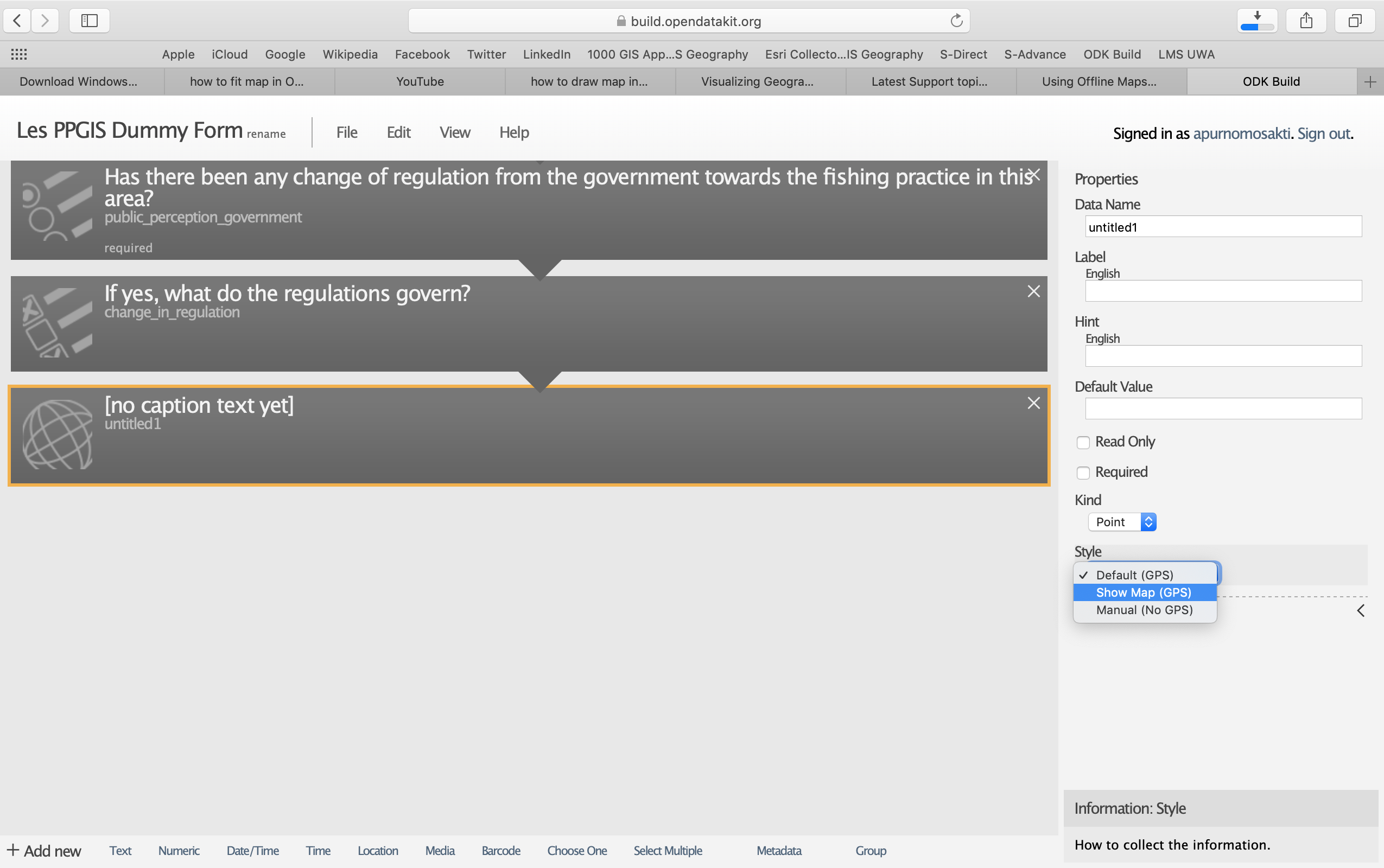
Hi Everyone, I am a Master of Environmental Science Student currently undertaking a data collection for my thesis project. My research will encompass the use of Public Participation Geographic Information System (PPGIS) for Locally Managed Marine Areas. In my research, I will be using ODK to collect the responses from the respondent in a developing country, arguably in a village where a connection is a bit tough to get. I am designing my survey using ODK Build Beta version 0.35.
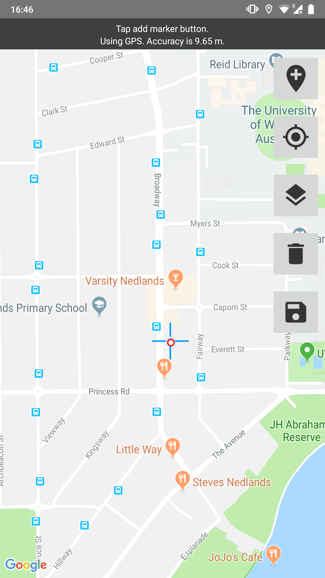
So far, I managed to get all my questions across the ODK build platform except for one issue which I would like to ask here. As a part of the data collection, I am going to ask the respondents to drop pins in certain area that indicates the location in which they mostly exploit the natural resources. I will need to show the research area in the interface and get the respondents drop up to three points. I have tried to add the map in the interface as shown in the screen shot below.
However, I am having difficulties in getting the respondents to drop more than 1 pin on the interface. Is there a way to solve this? Alternatively, I am wondering if someone every has ever undertaken a similar type of data collection using ODK and if there is a way for me to fit the offline map interface into map and get the responses across? In the end of the day, my output will be as a form of map where the respondents mostly drop the pins and analyse the density of the points dropped by the respondents.
Thank you very much for the help